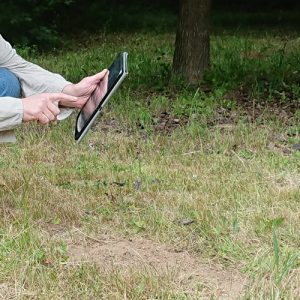
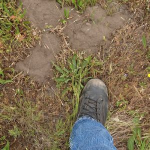
 Whether it’s called a “review,” a “study,” or a “survey,” it all comes down to the same thing: the county needs to know if gophers are living on your land. Our fully approved gopher surveys get the answer. Upon completion, we provide you with your own copy of the survey to do with as you wish. We never contact or share information with the county as part of our survey process.
A gopher review usually requires more than one survey: an initial visit and one or more follow-up visits. For the initial visit, we charge a little more because we have to set everything up for the first time. Follow-up visits cost a bit less because we already have your property set up in our databases.
First Full Survey
The first time we do a pocket gopher survey on your property, we complete the following tasks:
- Compile the most current information on your parcel(s) from county, state, and federal databases
- Create a custom database for your project in our geographic information system (GIS)
- Survey the entire parcel(s) for gopher activity, following approved US Fish & Wildlife Service protocols
- Document the survey using GIS and handwritten field notes
- Upload the survey data into our secure databases
- Record all survey information on two separate government forms: one for USFWS and one for the county
- Produce a custom survey map that satisfies county, state, and federal requirements
- Compile the entire set of forms and other survey data as a digital document (PDF) and send it to you via email
- Post your survey on our secure server for you to download and copy as needed
If gopher activity is detected on your property during the initial survey, the review concludes after the first visit. You will not need any follow-up visits.
Follow-up Surveys
Follow-up surveys must be completed at minimum intervals of 30 days. They are identical to the initial survey, but we already have your databases created and ready to go. For all follow-up surveys, we complete the following tasks:
- Survey the entire parcel(s) for gopher activity, following approved US Fish & Wildlife Service protocols
- Document the survey using GIS and handwritten field notes
- Upload the survey data into our secure databases
- Record all survey information on two separate government forms: one for USFWS and one for the county
- Produce a custom survey map that satisfies county, state, and federal requirements
- Compile the entire set of forms and other survey data as a digital document (PDF) and send it to you via email
- Post your survey on our secure server for you to download and copy as needed
Survey Visit Preparation
Before each survey visit, your job is to make sure that the site is clear of major obstacles and that vegetation has been mowed or otherwise controlled so that the surveyor has a clear view of the ground. If you aren’t sure about the condition of the property or if you have concerns, you might consider starting with an Initial On-site Consultation (you can credit the cost towards your first full survey).
